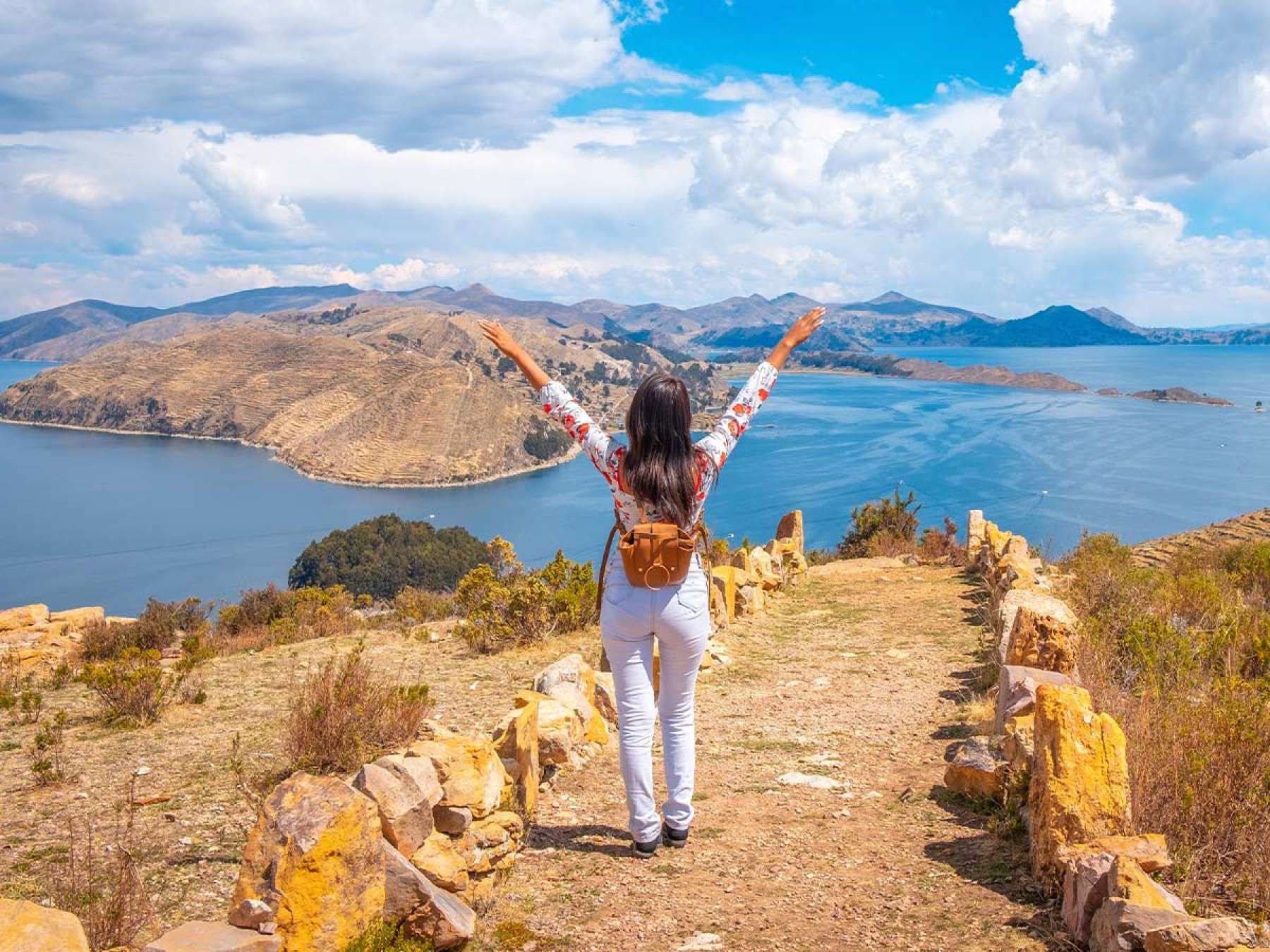
Lake Titicaca, located in the Andean high plateau, is considered the highest navigable lake in the world. With a surface area close to 8,000 square kilometers, it is one of the largest lakes in South America, and its waters are shared between Peru and Bolivia.
On its shores and islands live Aymara and Quechua communities that have kept their language, their textiles, and their way of relating to water. Did you know that some islands are built by hand with totora, a plant that grows in the lake itself? This is the case of the Uros islands, whose inhabitants renew the layers of totora to keep the ground firm. The lake also holds a central place in Inca tradition, which tells that Manco Capac and Mama Ocllo, the founders of the Empire, emerged from its waters.
In this guide you will find the necessary information to plan your trip to Lake Titicaca: how to get there, its history, the myths and legends of its origin, the attractions you cannot miss visiting, the best time to travel, and practical tips to take care of yourself against altitude sickness.
The lake is located at 3,812 meters above sea level and its surface is approximately 8,000 square kilometers. The maximum depth is estimated at 281 meters, with many areas not exceeding 40 meters. The lake is divided into two water bodies joined by the Tiquina strait. The Major Lake (Chucuito), to the north, has about 6,450 square kilometers and concentrates the greatest depth, near Sun Island. The Minor Lake (Wiñaymarca) measures about 2,112 square kilometers and reaches 45 meters in depth.
Key data
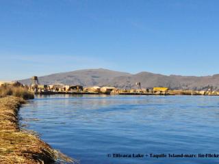
The most characteristic plant of the lake is the totora, a reed that grows in shallow areas. The locals use it to build floating islands and traditional boats, and also as food and material for roofing houses.
Among the animals, the Titicaca giant frog stands out, an endemic species that lives only in the lake and is in danger of extinction according to the IUCN. There are also endemic fish of the Orestias genus (like the carachi), besides introduced species like trout and silverside.
The lake is important for aquatic birds. In the Peruvian zone, there is the Titicaca National Reserve, which protects its wetlands. There you can see coots, Andean ducks, parihuanas (Andean flamingos), and the Titicaca grebe, an endemic bird of the high plateau.
The lake has been a population center for more than two thousand years. Between approximately 300 BC and 300 AD, the Pukara culture developed to the north, known for its stone sculpture and pottery. Afterward, Tiahuanaco emerged to the south, in current Bolivian territory, one of the most influential cultures of the Andes during the first millennium AD.
After the decline of Tiahuanaco, around the year 1000, the basin came into the hands of Aymara lordships like the Colla and the Lupaca. The Incas incorporated them into their empire around the middle of the 15th century, and the region became part of Collasuyo. For the Incas, the lake was a place of origin and they raised sanctuaries on its islands. According to tradition, Manco Capac and Mama Ocllo, the founders of Cusco, came out of its waters.
The legend of Manco Capac and Mama Ocllo is not the only one that relates the lake to the origin of the Andean world. These are two other traditions.
Did you know...? There are different explanations about the name "Titicaca". One of the most repeated translates it as "puma rock", but researchers do not agree on its exact origin.
Titicaca is in the Andean high plateau, on the border between Peru and Bolivia. The most common starting point on the Peruvian side is Puno, which is at about 3,830 meters of altitude on the western shore of the lake. On the Bolivian side, the main destination is Copacabana, about 3 or 4 hours by road from La Paz.
Puno is the main access point on the Peruvian side and can be reached from Cusco, Arequipa, and Lima. Here we show you in detail how to get there:
| Origin | Means | Approximate duration | Reference price |
|---|---|---|---|
| Cusco | Regular bus | 6–7 hours | US$ 14 – 27 |
| Tourist bus (with stops) | 9 hours | US$ 45 – 65 | |
| PeruRail Titicaca Train | 10 hours | US$ 250 – 380 | |
| Arequipa | Bus | 6–7 hours | US$ 10 – 32 |
| Lima | Flight to Juliaca + transfer to Puno | Approx. 3 hours | US$ 150 – 260 |
| Bus | Approx. 20 hours | US$ 40 – 95 |
Prices and schedules vary depending on the company, the type of service, and the season. It is best to confirm them before traveling.
Most attractions are visited from Puno, either by boat on the lake or by road. These are the five that usually are not missing on a trip to the area.
The Uros islands are a short distance from the port of Puno, in the Titicaca National Reserve. They are built with layers of totora, the plant that grows in the lake, and the locals renew them regularly so that the ground stays firm. The houses, boats, and part of the crafts are also made with this material.
The visit includes an explanation of how an island is built and how the community lives. Whoever wants to can board a traditional totora boat, which usually costs about 15 to 20 soles extra. Textiles and crafts are also sold there.
Taquile is a little over an hour away by speed boat from the Uros islands, and the trip is longer in a standard tourism boat. The island is toured on foot along cobblestone paths with uphill sections, and no vehicles circulate. From the high parts you can see good panoramic views of the lake.
It is known for its textiles, woven by men and women, and UNESCO recognizes them as intangible cultural heritage. The community preserves a collective organization and traditional clothing. In local restaurants, grilled trout is served, which is usually included in day tours. During the colonial era, the island was used as a prison.

Amantani is an agricultural and community island, with farming terraces and trails that go up to the hills. In the high parts there are two ceremonial sites, Pachatata and Pachamama, from where you can see the sunset over the lake.
The main experience is lodging in a family home. Two-day and one-night tours include dinner and breakfast at the home, and in some cases there are dances and community activities at night. The prices of these tours start at about 73 to 78 dollars per person.
Sillustani is a pre-Inca funeral complex located on the shores of Lake Umayo, north of Puno. It is distinguished by its chullpas, stone towers that were used as tombs. Some reach several meters in height and have very precise masonry.
The site is visited by road, in a tour that takes a few hours with transfers. Many agencies offer it in the afternoon, after visiting the islands, or as a separate half day. It is a good idea to bring a jacket, because the wind tends to be strong.
Puno is the starting point for most trips to the lake and also has its own attractions. It is known as the capital of Peruvian folklore for its dances and festivities, among them the feast of the Virgin of Candelaria, in February.
In the Plaza de Armas is the Cathedral, in baroque style and built in the 18th century. From the Kuntur Wasi viewpoint you have a wide view of the city and the bay. Other sites of interest are Lima street, pedestrian and with cafes and restaurants, and the Carlos Dreyer Museum, which gathers pieces from the cultures of the region.
Besides visiting the islands and archaeological sites, the lake offers experiences that allow you to learn how the local people live. These are the most common ones:
1 day tour. It is the shortest option and combines the Uros islands with Taquile. The tour leaves from the port of Puno in the morning and returns in the mid-afternoon. By speed boat, the trip between Uros and Taquile takes a little over an hour, and the return to Puno is usually close to 3:30 p.m. Some agencies add Sillustani in the afternoon, with road transportation.
2 day and 1 night tour. It includes Uros, Amantaní, and Taquile. The first day you visit a Uros island and continue toward Amantani, where you have lunch and spend the night in the house of a family. The second day you have breakfast, travel to Taquile, and return to Puno in the mid-afternoon. Generally, the tour includes hotel pickup, the shared boat, the guide, accommodation, and meals in Amantaní.
Experiential tourism consists of lodging with families in the community and participating in their daily routine. In Amantaní, the visitor shares meals, learns about the island's customs, and, in some cases, attends the dances organized by the community at night. Outside the islands, the Capachica peninsula and the Llachon area also offer accommodation with families.
The gastronomy of the area is based on highland products:
Feast of the Virgen de la Candelaria (February). It is the main celebration of Puno and is recognized by UNESCO as Intangible Cultural Heritage of Humanity. The main day is February 2, with a procession through the streets of the city. Activities begin in late January with novena masses and continue until mid-February, with dance contests in the stadium, among them the diablada and morenada, and farewell ceremonies. It is a time of high demand, and hotel occupancy in Puno is usually high weeks in advance.
Tourist Week of Puno (November). It revolves around the anniversary of the city, which was founded on November 4, 1668. That day there is a Te Deum mass and a solemn session. On November 5, the emergence of Manco Capac and Mama Ocllo from the waters of the lake is staged. The actors arrive by lake to the port esplanade and walk through the streets toward the Enrique Torres Belón stadium, while distributing potatoes and corn to the public. Anniversary activities begin weeks before.
The lake offers good spots for photography, especially because of the light at sunrise and sunset. Some recommended places:
On the water there are several options: the totora boat ride in Uros, speed boat or tourist boat tours to the islands, and kayaking, which some agencies offer. It is best to protect equipment from the sun and wind, and ask for permission before photographing people.
The climate of the high plateau is divided into two seasons: a dry season and a rainy season. The best time depends on what you look for: clear skies to tour the islands and take pictures, green landscapes, or participation in a festivity. Throughout the year, the difference between day and night is large. During the day there is plenty of sun, and at night the temperature drops quickly.
| Month | Approximate climate | Advantages | Disadvantages |
|---|---|---|---|
January | Rainy and cloudy, cool nights | Green landscape, fewer tourists | Frequent rains, cloudy skies |
| February | Rainy, cool nights | Candelaria Fest (central day: February 2) | Full hotels and high prices during festival dates, rains |
| March | Rains decreasing, still cloudy | Green landscape, few tourists | Rains still present |
| April | Transition, more clear days | More stable climate, few people | Some rains, cold nights |
| May | Dry, clear skies, cold nights | Good weather for the islands, fewer tourists than in July and August | Nights with temperatures near 0 °C |
| June | Dry and sunny, very cold nights | Clear skies, good light for photography | Frosts, high season begins |
| July | Dry, coldest month at night | Very clear skies | High season, advance booking required, very cold nights |
| August | Dry, somewhat windy | Clear skies | High season, cold nights and wind |
| September | Dry, slightly less cold nights | Good weather, fewer people than in July and August | Windy on some days |
| October | Dry, with occasional rains at the end | Good balance between climate and crowds | First rains may start |
| November | Rains begin | Puno Anniversary and November 5 staging | More cloud cover, intermittent rains |
| December | Rainy, milder nights | Green landscape, few tourists outside holidays | Frequent rains and cloud cover |
When to go? For clear skies and photography, from May to September. To avoid the coldest nights and the high season, April, May, and October offer a good balance. To experience a festival, February or November.
Lake Titicaca is at almost 3,800 meters of altitude, a height where many visitors feel the effect of less oxygen. This section explains what soroche is, how to prevent it, and when you should seek medical attention.
Soroche, also called altitude sickness or acute mountain sickness, is the body's reaction to the lower amount of oxygen available in high areas. It can appear starting from approximately 2,500 meters, and it does not depend on physical condition: young and active people also experience it.
The most common symptoms are:
They usually appear in the first hours or on the first night. In most cases they are mild and improve with rest and acclimatization in one or two days.
Puno is at a higher altitude than Cusco and much higher than Arequipa. This matters if you plan to do a combined route.
Reference altitude
If you arrive by plane from Lima to Juliaca, which is at an altitude similar to Puno's, you climb almost 3,800 meters in a few hours, without gradual adaptation. That is why many visitors feel the effect of soroche more when they arrive directly from the coast.
These remedies are part of local tradition and help some people feel better, but they do not replace gradual acclimatization or medical consultation. Soroche pills are also sold in pharmacies. It is best to ask a doctor or pharmacist before using them, especially if you take other medications.
Consult a doctor if:
These signs can indicate serious complications, like high altitude pulmonary or cerebral edema. In that case, the recommended action is to descend to a lower altitude and seek medical attention as soon as possible. On the lake's islands, medical services are limited, so it is best to notify the guide or host family immediately.
| Feature / Aspect | Peruvian side | Bolivian side |
|---|---|---|
| Base city | Puno | Copacabana |
| Approximate altitude | 3,800 m | 3,840 m |
| Main attractions | Uros floating islands, Taquile, Amantaní, Sillustani | Isla del Sol, Isla de la Luna, Copacabana cathedral |
| Type of experience | Experiential and cultural tourism, with organized tours | Hikes across Isla del Sol and Inca ruins |
| City size | Larger, with more services | Small, with more limited services |

 +51 84 226 547
 +51 912 891 560
 Av Tupac Amaru PP-10B, Santiago, Cusco, Peru
  info@salkantaytrekmachu.com
 www.salkantaytrekmachu.com