
The Madre de Dios River, also called the Amaru River, is one of the most important waterways in southeastern Peru. It flows through the Amazon region of Madre de Dios, crossing provinces like Manu and Tambopata, and forms the main river basin of this area. Its origin is in the department of Cusco, in the headwaters of the Pilcopata River, which is born in the heights of the Pucará Snowy Peak, southeast of the city of Paucartambo.
The river is not only vital for the Amazon ecosystems but also for the communities that live on its banks, as it is a source of transport, fishing, and economic activities. In addition, it borders protected natural areas such as the Tambopata National Reserve and the Manu National Park, considered World Heritage Sites for their extraordinary richness in flora and fauna.
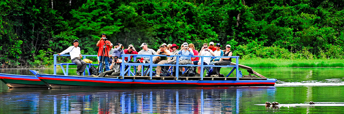
The Madre de Dios River is one of the most important waterways in the Peruvian Amazon. Its flow and its tributaries allow for navigation all year round, making travel easy from Puerto Maldonado to its junction with the Beni River.
During the rainy season, its waters get a deep brown color and its current becomes faster, offering a stunning natural spectacle. Its flow is due to it passing through one of the wettest areas of the Peruvian jungle, which makes it a vital river for the region.
Its main tributary is the Inambari River, which starts in Puno, though along its course it receives many tributaries that enrich it. Thanks to its length, the Madre de Dios River flows through areas of great biodiversity and is a source of life for local communities, who do activities like farming, selective logging of fine woods, mango cultivation, and, in some parts, gold mining.
On its banks are important protected areas, like the Manu National Park, the Tambopata - Candamo National Reserve, and the Manuripi-Heath National Reserve in Bolivia, which shows its huge ecological importance. Near Puerto Maldonado, the river reaches an average width of 150 meters.
Its main tributaries are:
The Madre de Dios River is born on the eastern slopes of the Vilcanota mountain range, part of the Eastern mountain range of the Peruvian Andes, northeast of Cusco. In this initial section, it is known as Alto Madre de Dios, and it flows north bordering the Manu National Park, a protected area since 1973 with a surface area of 15,328 km². Upon leaving the mountain range, it enters the high jungle and reaches the town of Pilcopata.
Further on, it passes through a curve to the west and receives the Manu River (356 km) on the right bank, in the town of Boca Manu. From this point, the channel takes on the characteristics of a floodplain river, with numerous meanders and sand islands along its course.
The Amazon on its way west, passes by Puerto Tahuantinsuyo, where it receives the Azul River, and further on incorporates the Colorado River. Later it reaches the town of Madre de Dios, where it receives the Los Amigos River on the left.
One of its most important contributions is the Inambari River (390 km), which descends from the eastern Andes and crosses the Bahuaja Sonene National Park, an area where a major hydroelectric plan is projected. Afterward, it takes in the Las Piedras River (640 km), its main tributary, near Puerto Maldonado (183 meters above sea level), the capital of the Madre de Dios department. This city, considered the Capital of Biodiversity of Peru, is an Amazonian commercial center that in 2005 had about 40,000 inhabitants and has an airport. At this point, the river also receives the Tambopata River (350 km).
From Puerto Maldonado, the river is known as Bajo Madre de Dios. It crosses small towns like Colombia and San Francisco, until it leaves Peru through Puerto Pando. In Bolivian territory, it reaches Puerto Heath, where it receives the Heath River (217 km), which marks the natural border between Peru and Bolivia.
The river continues its journey in a southwest-northeast direction, serving as the border between the Bolivian departments of La Paz (south) and Beni (north). It passes through towns like Puerto Pérez, Santa Rosa, Candelaria, Constitución, Villa-Mar, and Nazahuasama. In this area, the old meanders have formed oxbow lakes, among which the Murillo lake (11 km long), the Mentiroso lake (15 km), and the Diasada lake (5.5 km) stand out.
Finally, the Madre de Dios River flows into the Beni River, in front of the city of Riberalta (134 meters above sea level), which in 2001 had about 64,500 inhabitants and has an airport. Further on, the Beni River joins the Mamoré River in Villabella, giving rise to the Madeira River, one of the great tributaries of the Amazon.

The climate of Madre de Dios is tropical: warm, humid and with annual rainfall of over 1000 mm. The average annual temperature in Puerto Maldonado, capital of the department, is 26 °C; the maximum reaches 38 °C. in the months of August and September; the minimum drops to 8 ºC. There is a period of very little rainfall that covers the months of June, July and August. The rainy season is from December to March.
The climate of Madre de Dios is sometimes influenced by cold air masses that come from the southeast of the American continent, causing significant temperature drops, which lower the thermometer to 8 °C. and that are known locally with the names of "surazo" or "friaje"
In the Madre de Dios river basin, mining activity is dedicated almost exclusively to the gold, through small miners scattered along the Madre de Dios River, between Puerto Maldonado and its confluence with the Colorado River, and Huepetuhe.
These miners exploit the gold sands and gravels of the river beds and banks riverside. The exploitation method has two stages, the first is through selection gravimetric of the mineral, and the second by amalgamation of gold with mercury. The last stage is the contamination of the gold with mercury. In this last stage, pollution of the environment by dumping of surplus mercury into water courses water and miners by inhalation of the gases during the rewetting.
It should also be added that the indiscriminate felling of trees in riparian areas to use of gold banks, as well as the use of heavy construction equipment (front loaders) causes pollution of the environment by noise, degradation of the forests, accumulation of human waste, etc.
It should be taken into account that pollution is a seasonal phenomenon associated with periods of mining work that always occur in the low-water newspapers (June - September).
This conservation unit is located between the provinces of Paucartambo -The Convention of the department of Cusco, and those of Manu - Fitzcarrald from the department of Madre de Dios, it covers an area of 1,884,200 hectares.
It covers the Bioregions of: Low Forest, High Forest, High Andes and Puna, the Jungle being the largest go down with an impenetrable jungle. On correspondence with this geographical reality is there are also variations in the formation of forest, so, for example, on the first floor named you can see colorful fruits and flowers and trees that are up to 60 meters high.
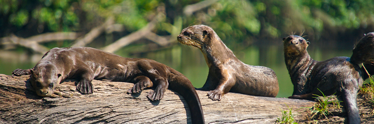
The Manu National Park contains a great diversity of animal species, with 860 species of birds such as: the harpy eagle, macaws, heron parrots, etc. felines like jaguars, 13 species of monkeys, bats, river wolves, black and white lizards, the taricaya. In addition, the Park Nacional del Manu is currently inhabited by 30 peasant communities and various native Amazonian populations.
This conservation unit comprises a total of 102,109 hectares that are they extend towards the border republic of Bolivia. It was created especially for the deer safety and conservation the swamps in their only habitat at all the territory of Peru; also for the conservation of flora and fauna belonging to the Heath River area. On the latter was preferred Consideration Regarding Maned Wolf (Chysocyon brachiuyus), the most burly from South America, who lives lonely among the grass of the pampas.
Tambopata Candamo Reserved Zone This covers a total of 1,400,000 hectares, from Puerto Maldonado, it is reached by road fluvial (Tambopata river); or by the Puerto Maldonado - Cusco highway (kilometer 30). To the get there are appreciated: the enormous biodiversity and habitats of each of the ecosystems, representing native flora and fauna with: 165 species and 41 tree families, 103 species of mammals, 1300 species of butterflies and 90 species of amphibians.
Also existing: jaguars, capybaras, huanganas, monkeys, turtles, alligators, river wolves (otters).
Also, where Tambopata and the river La Torre (60Km. from Puerto Maldonado), is the center of the area reserved (since 1977) to keep the ecology. The 'Esse'eja' population o 'huarayos', which are Amazonian natives occupy the reserve, along with quechuas and aymarás; who are dedicated to agriculture (coffee), hunting, fishing and gathering.

It is located 85 km from Puerto Maldonado. To go to that place a boat is boarded to motor and sail against the current of the Tambopata River for 4 hours and 30 minutes.
Apart from enjoying observing the landscape along the way, at the end of it, It is interesting to contemplate how the waters of the river fall forming a impetuous waterfall of three meters high and that the rainy season impresses mainly due to the increase in its flow.
This is located on the right bank of the Madre de Dios River, 40 km from Puerto Maldonado and 2 hours of navigation by motorized boat, commonly known as "pequepeque". The attractions of greatest interest in this community are the typical houses, slightly raised on wooden posts to avoid humidity and the access of the vermin, the crafts consisting of arrows, bows, multi-colored seed necklaces and fabrics based on vegetable fibers. The The inhabitants of this community are mostly known by the name of "huarayos".
It is located 50 km from Puerto Maldonado, of which the first 40 must be travel them by boat on the Heath River, for approximately 2 hours. The natives of this community belong to the same family of the huarayos with which they present very similar ethnic characteristics. However, it is possible to notice that the natives Miraflorinos conserve until now the uses and customs of their remote ancestors in comparison with the huarayos.
The distance between this community and Puerto Maldonado is 25 km, which is covered in one hour and 25 minutes sailing in a boat against the current of the river. On the way can observe riverine populations such as Isuyana, Tambopata, Chontal and Cascajal. This group of natives is dedicated in preference to agriculture, wood extraction and chestnut harvesting, whose demand is increasing. fishing is abundant in the rivers of the area.
Its origin is due to the strangulation of one of the meanders of the Madre de Dios River and It is located on the right bank of it, 8 km from the city of Puerto Maldonado. To get to this lake you have to sail by motor boat for 25 minutes following the current of the river, then you have to walk along a trail that advances in the woods for about an hour and thirty minutes. On the way enjoy observing a wide variety of plant species such as orchids, platanillos, ungurahuis and homiceas, within the lake itself the islets full of grasses existing swampy areas where the aguaje tree grow. As to wild animals, there is an abundance of ducks, otters, alligators, wild chickens, tapirs, toucans, macaws, water turtles like charapas. In this lake it is usually practice sport fishing by catching a wide variety of fish such as the paiche that It measures 1 to 4 meters in length. There is a sector of the lake in which the temperature fluctuates Between 20 ° C and 26 ° C, here visitors can enjoy a refreshing swim without run no danger.
It is located 60 km from Puerto Maldonado downstream of the Madre de Dios River and the trip lasts approximately 4 hours. The flora and fauna distributed around this lake are varied and that is why they are tempting for the curiosity of visitors. The fishing enthusiasts find a suitable field to catch fish such as croaker, dorado, the maiden, among others. Some restaurants in Puerto Maldonado have specialized in the preparation of exquisite stews based on these fish.
It is located on the left bank of the Tambopata River, 55 km from Puerto Maldonado, distance that is covered in 3 hours, before reaching the lake you have to walk through a section pedestrian for about 30 minutes. The scenery around the lake is rewarding because it offers a lush vegetation populated with birds.
The route to this lake is constituted by the combination of a paved road, a carriage trail and a short section of navigation on the Madre de Dios River, downstream from the mining port of Laberinto. The total distance from Puerto Maldonado to the The referred lake is 65 km long, which is covered in approximately 3 hours. In the lush flora of this sector, stand out the palm trees, the ungurahui, the aguaje, the cetico and the rubber.
With regard to its fauna, it has herons, macaws, paujiles, partridges, turtles and other wildlife.
It is located 25 km from the city of Puerto Maldonado and can be reached there by a road of affirmed land after a journey of approximately one hour. This lake is appropriate for the practice of sport fishing, because in its waters there is abundance and variety of fish. On the other hand, the attractive landscape of its surroundings houses quantities appreciable lizards, charapas, monkeys, butterflies of different colors and sizes and many species of birds, among which the sticks stand out.
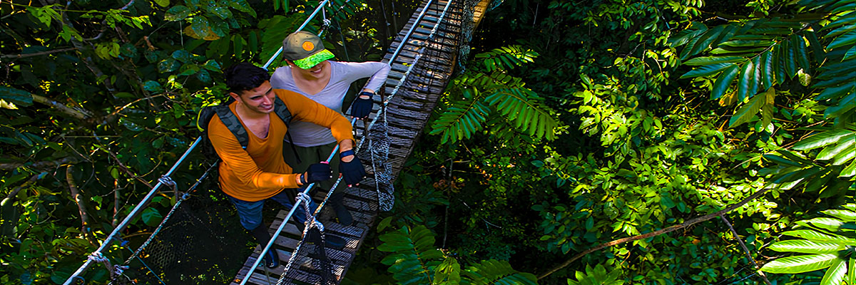
Exploring the Peruvian Amazon is to know a world full of wildlife, vast jungles, and communities that preserve traditions. Each tour allows you to discover amazing landscapes and live with nature in its purest state, turning the trip into an unforgettable experience. Learn about the most outstanding tours of the Amazon:
Inca Trail, Machu Picchu and more
 +51 84 226 547
 +51 912 891 560
 Av Tupac Amaru PP-10B, Santiago, Cusco, Peru
  info@salkantaytrekmachu.com
 www.salkantaytrekmachu.com


