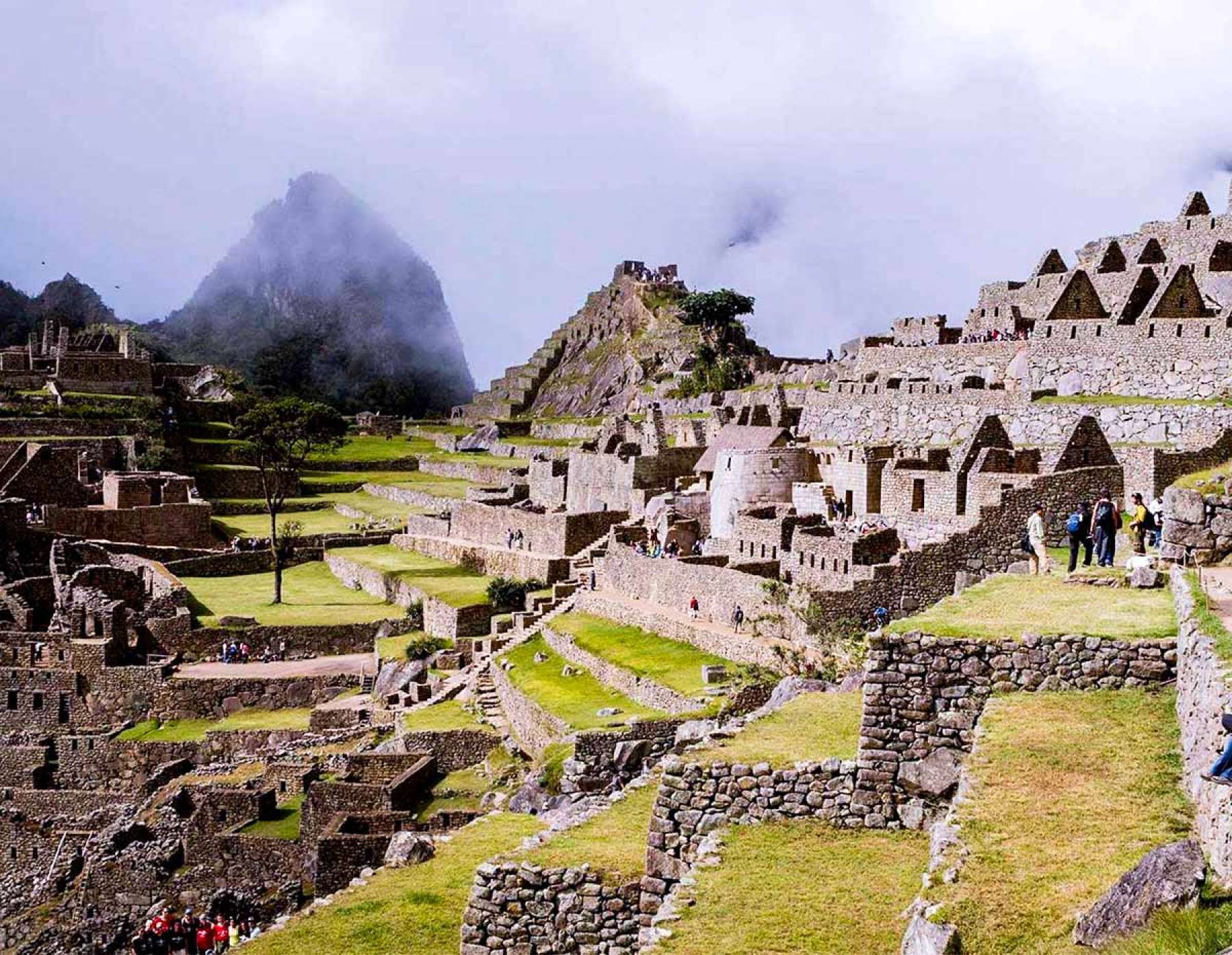
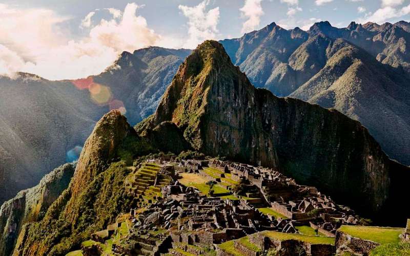
In 1911, when Hiram Bingham arrived at Machu Picchu guided by local farmers, he found a complete citadel hidden among the forest vegetation, carved on top of a mountain, that had survived more than five centuries of rain, tropical humidity and earthquakes, without a single drop of cement or mortar joining its stones.
Peru, the country where this Inca citadel is located, is placed in one of the most active earthquake zones, on the so-called Pacific Ring of Fire. And yet, while many Spanish colonial buildings (made centuries later, with "more advanced" techniques) cracked or collapsed during earthquakes, Machu Picchu is still standing, almost intact.
How did the Incas manage to build such detailed architecture? The answer is in a set of surprisingly advanced engineering solutions, designed not to look pretty, but to survive. In this article we are going to look at the pillars of Machu Picchu's architecture: the terrace system that stopped the mountain from falling apart, the water channels that supplied the whole citadel, the stone cutting technique that made earthquake-proof building possible, and the logic behind choosing the site itself.
Who ordered its construction? The traditional belief points to Pachacutec, the ninth Inca ruler, as the one responsible for ordering the construction of Machu Picchu during his rule (1438-1471). Colonial writers and John Rowe's historical reconstruction placed the start of the work around 1450, placing the beginning of the construction near 1450, ten years after Pachacutec took power.
However, a 2021 study led by Richard Burger (Yale) and Jason Nesbitt (Tulane) changed this timeline. Using accelerator mass spectrometry (AMS) on human remains found at the site, researchers concluded that the occupation of the site was continuous between approximately the year 1420 and 1530, which would bring forward the start of construction by at least two decades compared to the traditionally accepted date.
There is no single universally accepted theory. The main theories, backed by archaeological evidence, are:
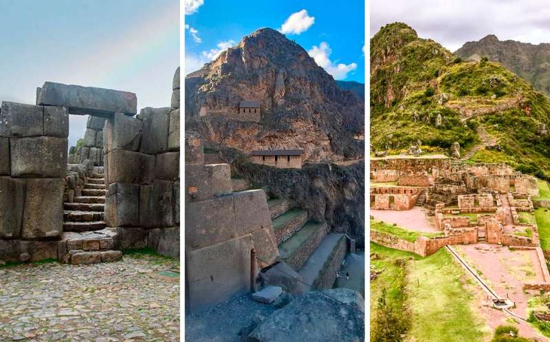
Fine Inca masonry is divided into two styles, classified by the archaeologist John Rowe in the 1940s: ashlar masonry (rectangular blocks, placed in rows) and polygonal masonry (irregularly shaped blocks, fitted together like puzzle pieces). Both styles share the same technical base: total lack of mortar. This technique was not unique to Machu Picchu, it is repeated, with changes, in Sacsayhuaman, Ollantaytambo, Pisac and many other Inca sites throughout the Cusco region.
The technique is known as dry-stone masonry. Where each block was carved individually to fit with its neighbors, instead of cutting stones to a standard size and filling the spaces with mortar.
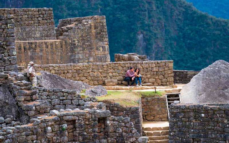
Not all of the citadel is built with the same level of detail. Fine masonry (ashlar or polygonal) was kept for higher status buildings: temples, palaces and ceremonial structures, like the Temple of the Sun or the Temple of the Three Windows. The rest (houses, storehouses, terrace retaining walls) was built with field stone and in some cases adobe, with a simpler technique.
This building order is repeated in other Inca sites, though with different focus depending on the purpose of the place:
The Incas did not have access to iron or steel tools. The cutting work was done with stone hammers (stones harder than the rock to be carved) by hitting: the surface was hit to break off small pieces until reaching the wanted shape.
This method was used consistently in the four mentioned sites, no matter the scale of the blocks, the same manual process was used for both the huge stones of Sacsayhuaman and the medium-sized blocks of Machu Picchu.
Why have the structures survived centuries of earthquakes? Cusco and the Sacred Valley are located in an area of frequent earthquake activity. Unlike the Spanish colonial buildings built on the same Inca bases (many of which fell down in later earthquakes), the fine stone Inca structures are still standing. The answer is not in a single part, but in a set of building choices: no mortar, wall shape, and underground foundation work.
By not using mortar, the blocks are not strictly tied to each other. During an earthquake, the joints allow the stones to move slightly (they "dance") and then return to their same place, instead of breaking as would happen with a stiff structure joined by mortar. This behavior is the reason why the term "dancing stones" is commonly used to describe the event.
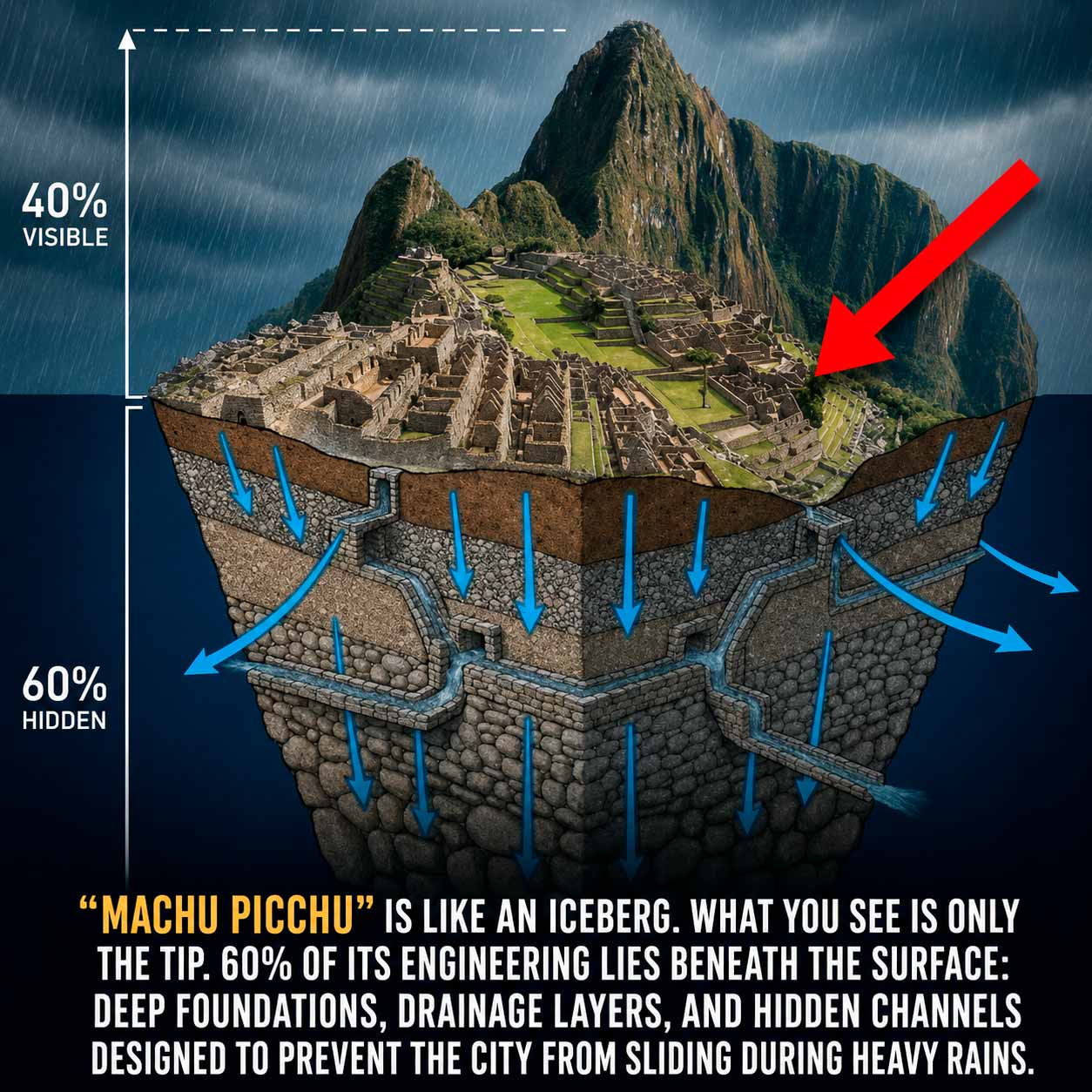
A less visible but equally important part is the underground work. Researcher Ken Wright, an engineer who studied the water and foundation system of Machu Picchu for years, estimates that between 50% and 60% of the total building effort of the site was spent on underground work: deep foundations, land preparation, and drainage.
About the wall shape, it is a recorded feature of Inca architecture that walls are built with a slight inward lean (slope), and that corners are usually rounded instead of forming sharp right angles. Both parts (lean and rounding) reduce the build-up of building stress during earthquake movement, compared to a fully straight wall with straight corners.
A clear and proven example of this building logic are the roughly 700 farming terraces of Machu Picchu, strengthened with granite retaining walls that help keep the mountain side stable.
The water system of Machu Picchu was carefully recorded by civil engineer Ken Wright and archaeologist Alfredo Valencia Zegarra, whose research was published in the book "Machu Picchu: A Civil Engineering Marvel" (2000).
Water reaches the citadel through a stone channel and inside the walls, it is shared out through 16 fountains connected in a waterfall, the "stairway of the fountains". The first one was saved for the emperor's home; according to Wright, it was actually the path of the channel that decided the location of that home, and not the other way around.
Did you know...?
About 30 km from Machu Picchu, near Cusco, is Tambomachay, known as "the Inca Baths", it shows a different approach to the same problem: instead of a long channel that supplies a whole city, this one focuses its engineering on two aqueducts carved right into the rock that keep a constant flow all year round, feeding a double matching fountain.
Under squares, yards, and inner paths of Machu Picchu runs a network of underground channels with stone slabs, which collects rainwater and leads it to the edges of the site. More than a hundred drains were counted spread all over the citadel, many still working.
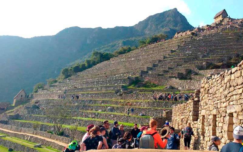
The terraces have a double function, on the one hand, they allow growing food on a steep slope. On the other, their granite retaining walls hold the mountain side and prevent landslides. Machu Picchu has about 700 terraces of this type; their retaining function is as important for the stability of the whole place as their farming function.
The farming terraces can also be seen in places like Pisac and Ollantaytambo, which show the same principle applied:
On the other hand, there is also Moray, which consists of circular concentric terraces, with a recorded temperature difference of up to 15°C between the top and bottom platform. The most common idea is that it worked as an experimental farming lab, used to test crops in different simulated microclimates.
Why did they choose that exact location? For decades the question of why the Incas built in such a hard-to-reach place did not have a strong technical answer beyond defense or spirituality.
But, a 2019 research by Brazilian geologist Rualdo Menegat, presented at the annual meeting of the Geological Society of America, gave a clear explanation: Machu Picchu sits exactly on the crossing of several tectonic faults, two main faults, called Machu Picchu and Huayna Picchu, which form a wedge block, plus a secondary pattern that almost draws an "X". According to Menegat, this was no accident, the same pattern is repeated in Ollantaytambo, Pisac and Cusco, all located on fault crossings.
This geological choice explains, in a concrete way, three practical advantages that were before only described vaguely:
Added to this is a cultural part, not just technical, the direction of the site towards surrounding sacred mountains (apus) and towards solar events like the solstices suggests that the choice also responded to a search for harmony between the urban layout and the sacred landscape.
Machu Picchu is organized, in academic terms, into two main sectors separated by a natural division marked by the geological fault itself:
| Fact | Detail |
|---|---|
| Buildings | More than 150 (baths, houses, temples, and sanctuaries) |
| Staircases | Over 100 flights, many carved from a single piece of rock |
| Block weight | Some blocks weighed over 50 tons (similar to a loaded train car) |
| Origin of the stone | Carved directly from the granite bedrock of the mountain itself, avoiding long-distance transport |
| Water sources | Supplied by 14 natural springs that fed the entire canal system |
| Seismic location | Built between two major fault lines, in a high-rainfall area prone to landslides |
| Fact | Detail |
|---|---|
| On-site resources | The location had its own water spring and a granite deposit for quarrying, both in the same place |
| Sacred meaning | The Incas worshipped the Sun, Water, and Mountains; the site connected several revered peaks with the sacred Urubamba River |
| The emperor's decision | Pachacuti himself insisted on building there despite the risk, prioritizing ceremonial value over ease of construction |
| First engineering challenge | Before building at the summit, they had to create a terrace and drainage system to stabilize the ground and prevent landslides |
| Fact | Detail |
|---|---|
| Founding | Around 1450 AD, under the Inca ruler Pachacuti |
| Context | Part of his strategy to consolidate power after reorganizing the Tahuantinsuyo |
| Active period | Between 80 and 100 years, before being abandoned by the Incas themselves |
| Years hidden | Nearly 400 years, until its rediscovery by Hiram Bingham in 1911 |
| Funding of the discovery | Bingham's 1911 expedition was funded by Yale University |
| The most astonishing fact | In less than a century of construction, without the wheel or hard metal tools, they built a citadel that has stood for 500 years |

 +51 84 226 547
 +51 912 891 560
 Av Tupac Amaru PP-10B, Santiago, Cusco, Peru
  info@salkantaytrekmachu.com
 www.salkantaytrekmachu.com