Peru is home to one of the most important archaeological legacies, covering more than 5,000 years of human civilization. Long before the rise of the Inca Empire, other cultures had already built cities, temples, and watering systems along the desert coast, the Andean mountains and the edges of the Amazon. This long timeline is what makes Peruvian archaeology so unique: it is not a single story, but a layered history, where each civilization built upon the next, conquered it, or absorbed it.
At the root of it all is Caral, in the Supe valley, north of Lima, known as the oldest civilization in the Americas, even older than the Olmecs of Mesoamerica by more than a thousand years. From there, the Peruvian archaeological record spreads through the Moche, Chimu and Nazca cultures on the coast, each of which left behind huge adobe cities, detailed pottery, and mysterious geoglyphs that are still not fully understood today. The story ends with the Inca Empire, whose engineering and stonework in sites like Machu Picchu, Ollantaytambo and Sacsayhuaman are still some of the most amazing building achievements in history, built without the wheel, iron tools, or a written language as we know it.
This guide takes you through the most important archaeological sites in Peru, from the famous citadel of Machu Picchu to lesser-known but equally fascinating places like Chan Chan, Kuelap and the Nazca Lines. For each site, you will find its historical importance, location, how to get there, and practical tips for the visit, whether you plan a short trip to Cusco or a longer journey through the diverse archaeological landscape of Peru.
| Site | Region | Culture | How to Get There | Approx. Price |
|---|---|---|---|---|
| Machu Picchu | Cusco | Inca | Train from Ollantaytambo/Cusco to Aguas Calientes, then bus or hike up | $45 - 50 USD |
| Choquequirao | Cusco | Inca | 2 day trek from Capuliyoc (Cusco region) | $16 - 18 USD |
| Ollantaytambo | Sacred Valley | Inca | By road from Cusco (~1h 45min) or included on the train route to Inca city | Cusco Tourist Ticket |
| Sacsayhuaman | Cusco | Inca | Short drive or walk from Cusco city center | Cusco Tourist Ticket |
| Pisac | Sacred Valley | Inca | By road from Cusco (~45 min) | Cusco Tourist Ticket |
| Moray | Sacred Valley | Inca | By road from Cusco, usually combined with Maras Salt Mines | Cusco Tourist Ticket |
| Chan Chan | La Libertad | Chimu | Short drive from Trujillo city | $3 USD |
| Caral | Lima | Caral-Supe | ~3 hour drive north of Lima | $3 USD |
| Nazca Lines | Ica | Nazca | Overflight or viewing tower near Nazca city | $70 - 100 USD (by flight) |
| Kuelap | Amazonas | Chachapoyas | Cable car from Nuevo Tingo, near Chachapoyas | $6 - 8 USD |
The Cusco region gathers the highest density of Inca archaeological sites in Peru, many of them a short distance from the city. These are the most important ones and the options to visit them.
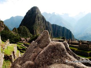
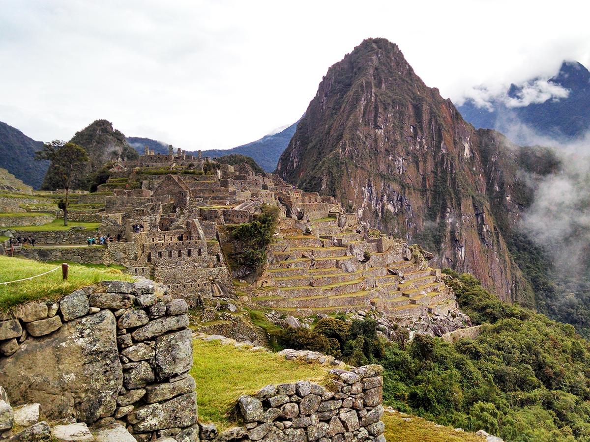
Machu Picchu is the most famous Inca citadel in the world and the main reason why millions of travelers visit Peru every year. Built in the 15th century as a likely royal home and ceremonial center, it is located at 2,430 meters above sea level, on top of a mountain surrounded by the high jungle and the Urubamba River canyon.
Its carved stone architecture, without the use of mortar, continues to amaze archaeologists and engineers to this day. In 1983 it was declared a World Heritage Site by UNESCO, and in 2007 it was chosen as one of the Seven Wonders of the Modern World.
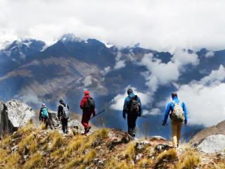
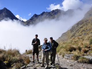
If you want to live the full experience arriving on foot through the original Inca trail, you can check out our classic Inca Trail or the Salkantay Trek to Machu Picchu, a less crowded option.
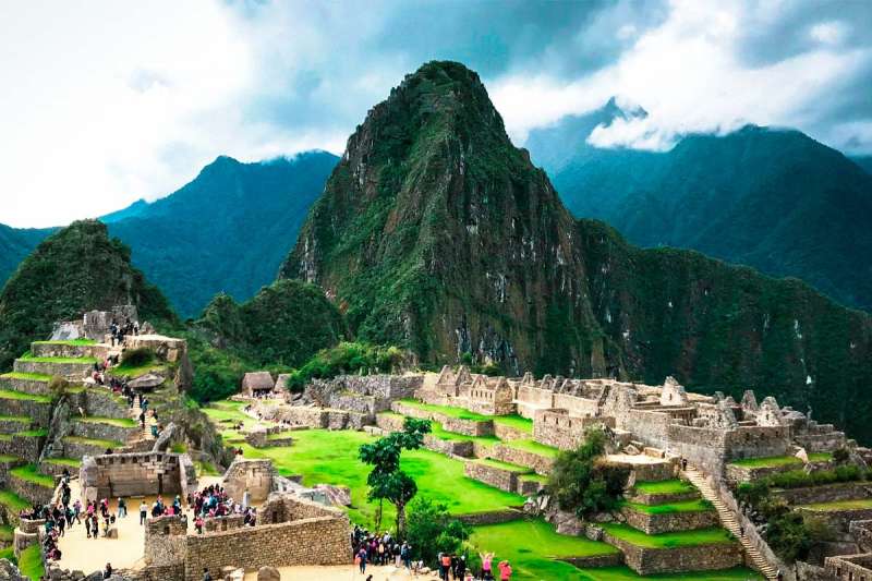
Choquequirao, whose name means "cradle of gold" in Quechua, is an Inca citadel considered the "sacred sister" of Machu Picchu due to its notable similarities: farming terraces, ceremonial squares, and stone buildings spread out on several levels on the mountain. Unlike Machu Picchu, it is estimated that only between 30% and 40% of the entire complex has been dug up, which makes it one of the archaeological sites with the greatest potential for discovery in South America.
Its remote location, at 3,050 meters above sea level and only accessible on foot, has kept this place much less visited than other Inca citadels, offering a quieter and more authentic experience for those who are willing to make the effort to get there.
If you are drawn to the idea of exploring an Inca citadel away from the crowds, our Choquequirao to Machu Picchu Trek combines both destinations in a single multi-day expedition.
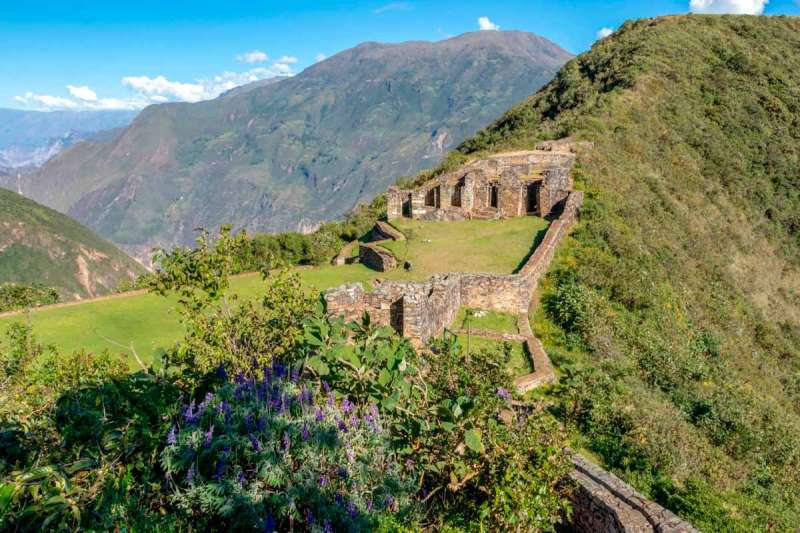
Ollantaytambo is one of the few places where the Incas achieved a military victory against the Spanish conquerors, led by Manco Inca in 1537. Located in the Sacred Valley, 60 kilometers northwest of Cusco, the complex worked as a fortress, administrative center, and religious temple.
Its most distinct feature is the huge stone farming terraces that go up the mountain slope, topped by a ceremonial center at the top, where you can see the Temple of the Sun with its perfectly put together stone blocks, brought from a quarry located several kilometers away.
Unlike other Inca sites, the town of Ollantaytambo keeps its original street layout, with streets and water channels that have been in continuous use since Inca times, which also makes it a living example of pre-Hispanic urban planning.
Ollantaytambo is part of the route to Machu Picchu on several of our tours, including our Sacred Valley of the Incas tour, ideal for seeing this and other archaeological sites in the valley in a single day.
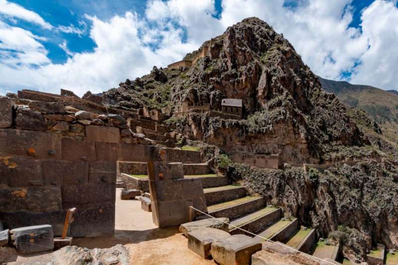
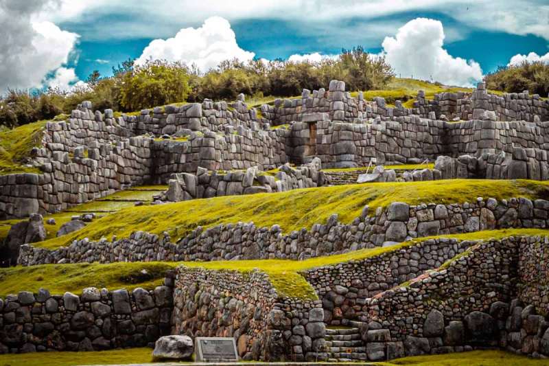
Sacsayhuaman is an Inca ceremonial and military complex located on the hills that overlook the city of Cusco, just a 15-20 minute walk from the Main Square. Its most impressive feature is the three zigzag walls built with limestone blocks weighing up to 200 tons, put together with such precision that they do not need mortar and have survived centuries of earthquakes.
The exact purpose of the site is still debated among archaeologists: it is given military, religious, and astronomical functions, being probably part of the urban design of Cusco, which according to some writers was planned in the shape of a puma, where Sacsayhuaman would represent the head of the animal.
Every June 24, the Sacsayhuaman square is the main stage for the Inti Raymi, the recreation of the Inca festival of the sun, one of the most important cultural events in Peru, which attracts thousands of visitors from all over the world.
Sacsayhuaman is a regular stop on our half-day tours around Cusco, like the City Tour Cusco, perfect for the first day of getting used to the altitude before a trek.
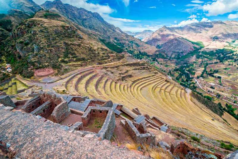
Pisac is an Inca archaeological complex located at the eastern end of the Sacred Valley, known both for its impressive farming terraces and for its famous craft market in the town of the same name. The archaeological site sits on a mountain that overlooks the Vilcanota River valley, combining military, religious, and farming functions.
Its amphitheater-shaped terraces, carved into the side of the mountain, were designed for growing crops in different microclimates depending on the altitude, a show of advanced Inca farming engineering. In the upper part of the complex is the ceremonial sector of Intihuatana, with stone buildings that show its religious importance, while on the nearby cliffs you can see hundreds of tombs carved into the rock, one of the largest Inca cemeteries found to date.
Unlike other sites in the Sacred Valley, Pisac offers the chance to combine history and local trade: when coming down from the archaeological site, the town's craft market is one of the most recognized in Peru, ideal to buy textiles and pottery made by local artisans.
Pisac is one of the main stops of our Combo Sacred Valley of the Incas Tour, ideal for exploring the Sacred Valley in a single day.
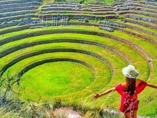
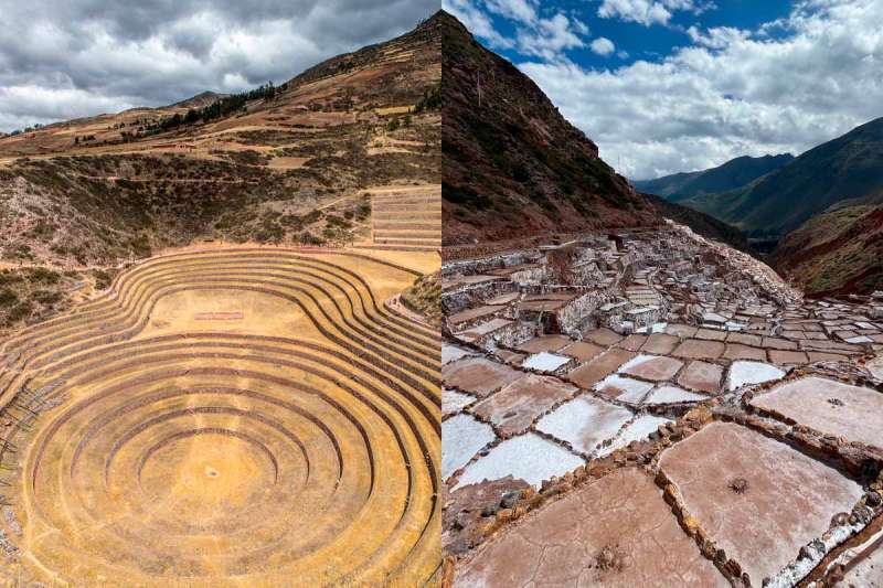
Moray is one of the most unique Inca archaeological sites in the Sacred Valley, formed by a set of stepped circular terraces that go down up to 30 meters deep, creating the look of a natural amphitheater. It is believed that it worked as an Inca farming lab, where they experimented with growing different types of plants taking advantage of the temperature changes between the top and bottom of the terraces, which can differ by up to 15°C.
This temperature difference would have allowed the Incas to simulate microclimates from different regions of the empire within the same space, making it easier to adapt crops like corn and potatoes to different altitudes before bringing them to other areas of the Tahuantinsuyo. The drainage system of the complex, which prevents flooding even in the rainy season, is another example of advanced Inca water engineering.
On the other hand, a few kilometers from Moray are the Maras Salt Mines, a set of more than 3,000 stepped salt pools on the side of a hill, which have been in use from pre-Inca times to the present day. The system takes advantage of an underground water spring with a high salt content that flows from the mountain; the water is shared through a network of canals to the pools, where it dries up under the sun, leaving the crystallized salt.
Unlike most archaeological sites in the region, the Maras Salt Mines are not ruins: it is an active and working operation, managed by the community of local families who have inherited the right to use the pools for generations. The visual result, thousands of white and orange terraces covering the side of the mountain, is one of the most recognized pictures of the Sacred Valley.
Moray and the Maras Salt Mines are part of our Maras - Moray - Salt Mines & Inca Trail tour, a great option for the day before a multi-day trek.
Before the rise of the Inca empire, cultures like the Moche, Chimu, and Lambayeque had already built huge cities, water systems, and a rich metal tradition on the north coast of Peru. This is the so-called "Moche Route", gathered between the cities of Trujillo and Chiclayo.
Chan Chan was the capital of the Chimu empire, the largest pre-Inca civilization on the north coast of Peru, and it is known as the largest mud-brick city in the world and the largest pre-Columbian city in America. It is thought that at its peak, around the 15th century, it housed tens of thousands of people, spread across nine walled cities, each built for a different Chimu ruler.
Its walls, decorated with geometric shapes and bird and fish designs carved directly into the mud, show the strong connection of this culture with the Pacific Ocean, which they depended on both for money and in spirit. Chan Chan was named a World Heritage Site by UNESCO in 1986, although it is also on the list of sites in danger, due to the wearing away caused by the rains of the El Niño weather pattern and being close to the sea.
The Huacas del Sol and de la Luna were the ceremonial and administrative center of the Moche culture, a civilization that grew on the north coast several centuries before the Incas. The Huaca del Sol, the largest mud-brick building in pre-Columbian America, probably worked as an administrative center, while the Huaca de la Luna had a religious and ceremonial role.
The most notable thing about the Huaca de la Luna are its colorful murals, kept in notably good condition, which show Ai Apaec, the main Moche god, along with scenes of ritual sacrifices. The site was only discovered in 1990, and to date only a small part of the total complex has been dug up, which suggests that there is still much to reveal about this civilization.
In the Lambayeque region, near the city of Chiclayo, there are two of the most important archaeological finds in Peru from recent decades. Tucume, known as the "Valley of the Pyramids", is a large complex of 26 mud-brick pyramids built by the Lambayeque (or Sican) culture, and later reused by the Chimu and the Incas.
A short distance away is Huaca Rajada, the site where in 1987 the intact tomb of the Lord of Sipan was found. He was a ruler of the Moche culture from the 3rd century AD, buried with funeral items made of gold, silver, and precious stones that have been compared in importance to the finding of Tutankhamun's tomb in Egypt. The original pieces are shown in the Royal Tombs of Sipan Museum, in the city of Lambayeque.
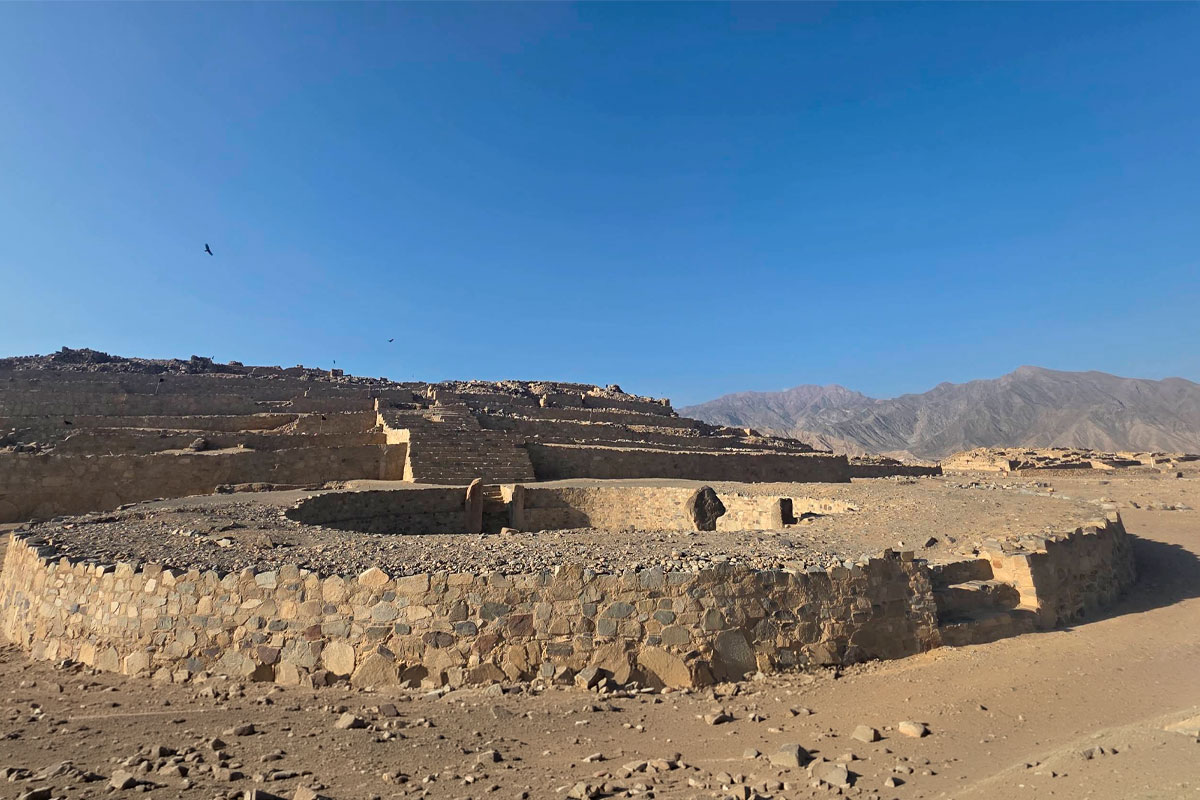
Caral is the oldest known city and civilization in America, with more than 5,000 years of history. Located in the Supe river valley, on the central coast of Peru, it grew between roughly 3000 BC and 1800 BC, being from the same time as civilizations like Ancient Egypt, Sumer, and India; although, unlike them, it grew in isolation, with no contact or trade with other great cultures of the ancient world.
What makes Caral especially important for world archaeology is that it reached a high level of social and architectural complexity (ceremonial pyramids, sunken circular squares, water systems, and a clear power structure) without having developed pottery or a writing system, and with no proof of being a warrior society: to date, no weapons or forts have been found at the site, which suggests that it was a peaceful civilization supported mostly by farming, fishing, and trade with other Andean regions.
The site remained mostly unknown until the Peruvian archaeologist Julio C. Tello recorded it for the first time in 1948. However, it was not until 1994, when archaeologist Ruth Shady started regular digging, that its true age was confirmed through radiocarbon dating, completely changing what was believed about the origins of civilization in America. In 2009, Caral was named a World Heritage Site by UNESCO.
The Nazca Lines are a group of geoglyphs drawn on the Ica desert, mostly linked to the Nazca culture, which grew between 500 BC and 500 AD. They are hundreds of figures (animals, plants, and geometric shapes) of such large sizes that they can only be fully seen from the air, which has fed the mystery about their real purpose for decades: astronomical theories, rituals related to water and fertility, and agricultural calendars have been proposed, without a final agreement among archaeologists to this day.
Their state of preservation is excellent thanks to the extremely dry and stable climate of the coastal desert, which has allowed these lines, made simply by removing the dark stones from the surface to expose the light soil underneath, to remain visible for more than 1,500 years. In 1994, UNESCO declared the Nazca Lines a World Heritage Site.
Kuelap is a huge fortress built by the Chachapoyas culture, known as the "warriors of the clouds", in the Amazon region of Amazonas, in northern Peru. The complex, located at 3,000 meters above sea level on top of a mountain, is surrounded by a limestone wall up to 20 meters high, inside which more than 400 circular structures that worked as homes and ceremonial buildings are preserved.
Because of its size and complexity, Kuelap is often compared to Machu Picchu, although it belongs to a different culture and time, and it receives a fraction of the visitors that arrive in Cusco, which makes it a much calmer option for those looking to explore less crowded archaeological sites.
Peru has very different climates depending on the region, so the "best time" depends on what sites you have on your itinerary:
Mountains (Cusco, Machu Picchu, Choquequirao, Kuelap), the dry season, from April to October, is the most recommended, with clear skies and a lower chance of rain. June and July are the months with the largest tourist crowds. Coast (Caral, Chan Chan, Nazca, Tucume), the weather is warm and mostly dry all year, so it can be visited in any season. However, it is recommended to avoid the coastal summer months (December to March) if you are looking for milder temperatures to walk long distances under the sun. Jungle and jungle edge (Kuelap, route to Machu Picchu via Santa Teresa), the rainy season (November to March) can make road access difficult in some areas, so the dry season is also preferred here.

 +51 84 226 547
 +51 912 891 560
 Av Tupac Amaru PP-10B, Santiago, Cusco, Peru
  info@salkantaytrekmachu.com
 www.salkantaytrekmachu.com