
The Nazca Lines are one of the most enigmatic archaeological sites in the world, declared a UNESCO World Heritage Site. They are a group of hundreds of large geoglyphs, drawn by the Nazca culture on the arid ground of the coastal deserts of the provinces of Nazca and Palpa, in the Ica region, in southern Peru.
The designs, which date back to approximately 500 B.C. to 500 A.D., include representations of animals (such as the monkey, the spider, and the hummingbird), anthropomorphic figures, and complex geometric patterns that can only be fully seen from the air. The purpose of their creation has generated various theories, the most accepted one being that of a massive ceremonial center related to the worship of water and astronomy.
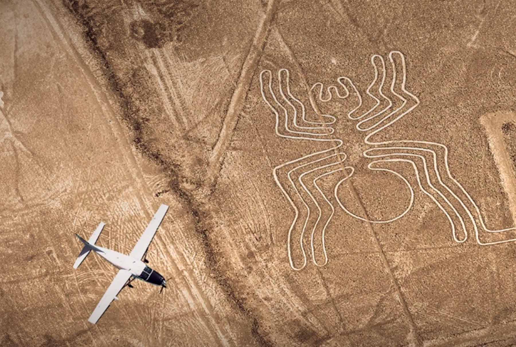
Due to the monumentality of the figures, the main method for their observation is flying over them in a small plane, an activity that attracts hundreds of visitors yearly. This guide is designed to provide all the information for planning a visit to the complex, including logistics and booking tips.
The Nazca Lines are located on the southern coast of Peru, within the Ica region. The geoglyph complex stretches along the desert plains that are mainly found in the provinces of Nazca and Palpa, covering a total area of approximately 450 square kilometers.
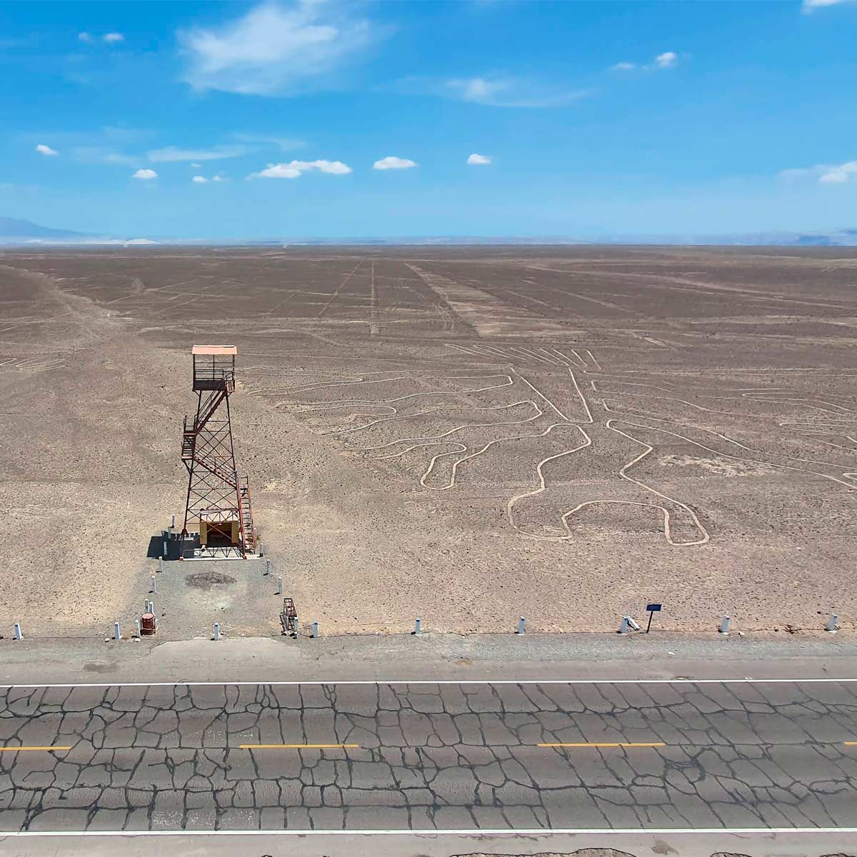
Geographically, the site is in the coastal desert of the Pacific. The geological feature of the soil and the almost total absence of rain in this region are factors that have allowed the amazing preservation of the geoglyphs for more than two millennia. Logistically, the central area of the Nazca Peru plain is about 450 kilometers south of the city of Lima, a route accessible via the South Pan-American Highway, where the observation towers and airfields are also located.
The study of the Lines was started by the American anthropologist Paul Kosok, who was the first to suggest that they represented an astronomical calendar. The preservation and research were continued and promoted by the German archaeologist Maria Reiche, who dedicated a large part of her life to their study. The lack of a final agreement on the ritual purpose of the figures is what continues to attract the attention of archaeologists and curious people.
To appreciate the figures from the Nazca Lines in their entirety, there are three main methods, as they are not visible at ground level:
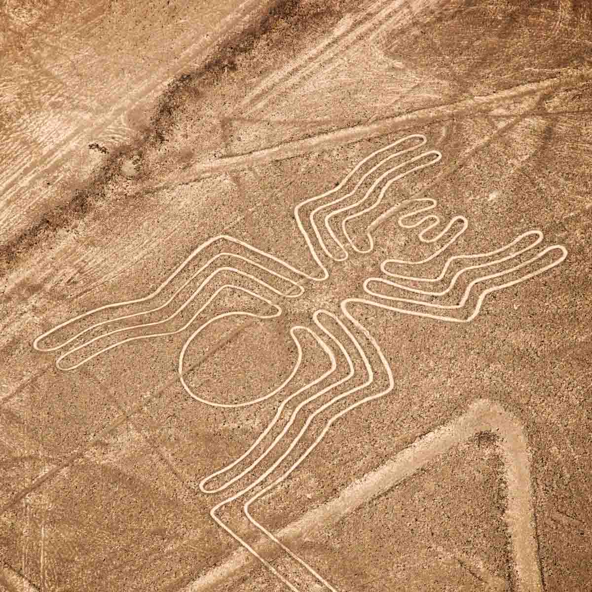
The Nazca and Palpa complex covers close to 800 cataloged geoglyphs. The most famous figures from the Nazca Lines and those visible from the air include the hummingbird, the condor, the pelican, the monkey, and the spider. The scale of these drawings is monumental, with some zoomorphic figures reaching 300 meters in length.
The age of the creation of the Lines ranges between 500 B.C. and 500 A.D. The reason for their excellent preservation over more than a millennium is due to the stable climate of the region (little rain) and the upper layer of iron oxide that acts as protection, preventing the wind from erasing the clearer soil underneath.
The creation of the Nazca geoglyphs spanned a period of about 1,500 years. The total area covered by the lines is immense, with estimates that range between 400 and 800 square kilometers. The individual dimensions are remarkable: the width of the furrows varies between 40 and 210 centimeters, while the depth of the furrows is minimal, reaching no more than 30 centimeters. The length of the largest figures, such as the lizard or the monkey, is close to 300 meters.
The Nazca Lines were made using a simple but precise subtraction process. The creators removed the darkened rocks (oxidized by time and weather) that formed the surface layer of the desert. When this layer was removed, the lower layer was exposed, which, not being affected by oxidation, keeps a lighter color. This strong color contrast is what allows the figures and lines to be visible from a great height. The hypothesis is that the making of the figures on a monumental scale was achieved using a grid system made with wooden stakes and ropes.
The theme of the figures is varied, and includes zoomorphic, anthropomorphic representations, and complex geometric shapes (trapezoids, spirals, straight lines that extend for kilometers).
The durability of the Lines, despite their age, is due to a unique mix of climate and geographic factors. The almost total absence of rain prevents water erosion. In addition, the presence of hot air rising from the desert plain shifts the wind, which protects the shallow furrows from being covered by sand.
 |  |
Due to the fact that these monumental lines can be seen from the air, many speculations have arisen to explain their purpose.
In an article called "Nazca Lines: a new synthesis of data from the Pampas and the Valleys", Anthony Aveny and Helaine Silverman report that at least four different hypotheses can be recognized about their function, use and meaning that surround these geoglyphs in a sea of confusion: as an alien landing strip, as pre-Hispanic sports tracks, as a religious center or as an astronomical orientation system.
For Aveni and Silverman, who do not deny that the Nazca geoglyphs can function as an astronomical system and a calendar, it is necessary to understand that they account for other social, religious and political functions at the same time.
Thus, the solar orientations that, indeed, are recognizable in some of its lines, may have to do, rather, with a system of omens related to the arrival of water in this area, which is basically a desert. This theory is based on the fact that there is evidence that the choice of the location of the lines is linked to the direction of the hills and the water sources.
It is also possible, according to the authors' research, that the Nazca lines were related to the ceque system of the Inca culture. The ceques were imaginary radial lines used in Cuzco to plan the distribution of water according to social importance and, also, to fulfill religious functions. For Aveni, this could have applied in Nazca. It is also possible that some of the lines could have functioned as ceremonial pilgrimage roads, for example, and not just as simple communication routes.
Along with this, the researchers point out that there is an identity between the figures of the geoglyphs with the motifs that decorate the Nazca ceramics. Silverman carried out a series of excavations in Cahuachi (Nazca valley to the South of the Pampa), in which elements of a ceremonial center were discovered, endowed with a complex of geoglyphs that accompany pyramids, temples, squares and ritual offerings.
This information shows that, indeed, there are elements to believe that the Nazca monumental geoglyphs correspond to a complex sociocultural system, which in turn is confirmed by the discovery of at least 500 archaeological sites dating from the period to date. between the year 500 B.C. until the colonization of America. Part of these sites, according to the referred article, are civic-ceremonial centers, cemeteries, villages, other geoglyph systems (these are geometric and not biomorphic), etc.

Many are the routes that take you to Machu Picchu, but none is like the Inca Trail Tours, the most famous pedestrian path in the Americas. After flying from the capital of Perú, Lima, you will arrive in Cusco to walk for four days along a path through forests and dense fog, millenary stone steps and discovering the ruins of ancient fortifications and Inca cities, and all the time enjoying majestic views.
 +51 84 226 547
 +51 912 891 560
 Av Tupac Amaru PP-10B, Santiago, Cusco, Peru
  info@salkantaytrekmachu.com
 www.salkantaytrekmachu.com


